First off, let me apologize to everyone who's been looking for the next posting. I managed to over-run the limit on my cousin's internet account and they cut us off. So we had to go in to the office and get things straightened out and get a higher ceiling, so now we're all set.
It turns out that my cousin has a son-in-law who owns an interest in an airplane and the airplane, a Cessna 170 tail dragger, is stored in a hanger down the road.
He graciously offered to take me up to see Sedona at daybreak one day when the winds were calm. Tuesday of this week was that day. I got up at 4:30 and we took off at 6:00 just after dawn. The winds were glassy smooth and the weather was perfect. We flew at an altitude of 500-800 feet so the view was just magnificent. I could see cattle and deer on the ground. We crossed over into the Verde Valley and headed North.
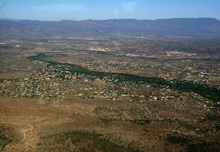
That's the Mogollon Rim in the background and the Verde River is the strip of green. A little later, we passed over Montezuma Well.
The well is part of Montezuma Castle National Monument located 11 miles away and is a natural limestone sinkhole. It is 368 feet across and 55 deep and flows 1,500,000 gallons of naturally carbonated water daily. The well is home to several unique species and contains high levels of arsenic.
This is the village of Oak Creek. Sedona is behind the set of hills on the right.
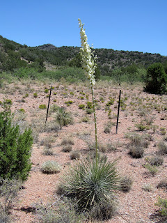
Here's a look at one of the hills on the way into Sedona. The opening photo shows Sedona in the background. If you look carefully at the left side of the opening photo, you'll see the other side of Coffee Pot rock that I showed in an earlier post. Their were so many views, it was hard to keep up with them.
I took along three cameras and used them all. I took what I thought at the time was a lot of video, but in the end I only wound up with 11 minutes of usable footage. I'm working at editing that into a viewable film but here is one clip:
At one point, we were able to circle by an ancient cliff house.
Running out of Clarkdale is the Verde Canyon Railroad. It once served the copper mines up the valley and now runs excursions. We were able to see part of the track layout and I hope that we can soon ride it. That also brought us back down the valley so that we could see Jerome in the distance. All of the towns around here have a large white letter posted on the hillside so pilots can tell where they are. The large factory in the foreground is a cement plant mining in the largest naturally occurring cement deposit in the Southwest.
On the way back, we stopped at the Cottonwood airport to top off the fuel tanks. Aviation fuel cost $5.63 a gallon and we used 6.2 gallons per hour.
We discovered that the back tire on the tail wheel was flat after we finished fueling. We had to wait for a friend of the pilot to show up with an air compressor to pump it up so we could take off. It went flat before we landed again but we made it without incident. We did take time on the return to do a fly by of the house where we are staying. You can see the motorhome parked next to the shop.
It was just the greatest way to see Sedona and, again, my pictures just don't come close. I really appreciate the unique opportunity to view the area. Thanks John.


